Design Survey Services
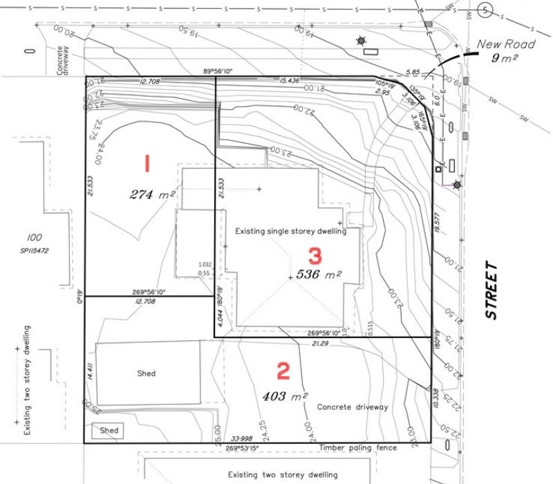
Design surveys provide architects, building designers and engineers with accurate and relevant land and structural information to confidently design for the relevant project. The purpose of design surveying is to provide locally relevant land, spatial and building information to identify site features, details, contours and constraints so that designing can be carried out successfully.
Brisbane Office: 07 3520 0948
Gold Coast Office: 07 5646 4367
For more information on surveying services specific to design, see below:

Proposal plans are documents that show property boundaries including any infrastructure such as houses and sheds in relation to the boundaries along with the proposed development.

Go to Contour & Detail Survey

The purpose of an identification survey (boundary survey) is to determine the true location of the boundaries of a particular property.
Go to Identification Survey

Go to Subdivision Survey

Height surveys and certifications largely relate to surveying a finished floor level or roof height for a newly constructed structure.

The purpose of an as constructed survey is to verify that construction or installation of a particular structure or service has been built or erected in accordance with the approved plans.
Topographic and Feature and Level Surveys capture ground elevation and terrain contours down to the millimetre.
We would love to work with you.
Tell us about your project via the form below or get in touch over the phone to discuss how we can improve your project.

