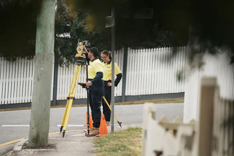
Our Topographic or Feature and Level Surveys work together to give you an ultra-accurate site assessment that captures ground elevation and terrain contours down to the millimetre. Sonto often integrates LiDAR 3D scanning with advanced geospatial technology to capture terrain elevations and site features with unparalleled accuracy, offering a comprehensive lidar topographic survey solution for precise land analysis across Brisbane, the Gold Coast, and surrounding areas.
If you’re an architect, an engineer, or a land developer, you need more than just a basic survey to guarantee a job well done. What you need is a complete, high-definition representation of all natural and built features from surveyors that put total innovation at the forefront.
So whether you need a single type of survey or a combination of both, we provide you with a high-definition, fully integrated land and property mapping solution that delivers all the insights you need to move forward with confidence.
Only the most accurate terrain and elevation mapping will make sure your project is correctly planned and your construction can go ahead.
Our surveys capture all levelling, site contours, and structural details with industry-leading precision to guarantee your designs are built on reliable data, minimising delays by avoiding errors and making sure your construction is smooth.

Innovation is at the heart of what we do, and we make sure that the most advanced, cutting-edge topographical surveys are provided to you in a way that’s easy to understand.
Using advanced LiDAR 3D scanning, GNSS positioning, and total station surveying, we’re not only able to deliver the highest-resolution data, but will also do so faster than other, more traditional survey methods.
We provide you with survey-ready data that’s compatible with industry-standard software like Revit, AutoCAD, and GIS platforms. This makes your workflow far more efficient by allowing you to easily add precise survey data directly to your designs and work site maps.
With access to precise mapping that tracks and analyses terrains and provides you with key structural insights, Topographic and Feature Surveys help you anticipate any potential dangers before the construction process begins.
Only the most accurate terrain and elevation mapping will make sure your project is correctly planned and your construction can go ahead.
Our surveys capture all levelling, site contours, and structural details with industry-leading precision to guarantee your designs are built on reliable data, minimising delays by avoiding errors and making sure your construction is smooth.
Contact us for a quote
Innovation is at the heart of what we do, and we make sure that the most advanced, cutting-edge topographical surveys are provided to you in a way that’s easy to understand.
Using advanced LiDAR 3D scanning, GNSS positioning, and total station surveying, we’re not only able to deliver the highest-resolution data, but will also do so faster than other, more traditional survey methods.
Contact us for a quoteWe provide you with survey-ready data that’s compatible with industry-standard software like Revit, AutoCAD, and GIS platforms. This makes your workflow far more efficient by allowing you to easily add precise survey data directly to your designs and work site maps.
Contact us for a quote
With access to precise mapping that tracks and analyses terrains and provides you with key structural insights, Topographic and Feature Surveys help you anticipate any potential dangers before the construction process begins.
Contact us for a quote
At Sonto, our approach is to support your vision with precise, actionable data that enhances design accuracy, cuts down on project timelines, and makes sure you have total transparency at the outset of your development.
We make sure that you have the most comprehensive, contextually rich survey datasets at your fingertips to improve the outcomes of your design and construction.

We conduct an initial site assessment using GIS data, existing survey records, and high-resolution aerial imagery to pre-calculate survey control points and optimise fieldwork.

Our state-of-the-art LiDAR technology captures millions of data points across the site, generating an accurate 3D representation of terrain and built structures.

By integrating boundary data as well as GNSS derived AHD height data we establish site control that ensures data consistency and accuracy across all project stages.

Using survey-grade point clouds, we extract site contours, terrain models, and critical features to create a detailed topographic map or digital terrain model (DTM).

Receive customised deliverables in the format best suited for your project, including topographic maps & contour plans, 3D point clouds & high-definition 360° imagery, Digital Terrain Models (DTMS) & Digital Elevation Models (DEMS), cad-ready files for engineering, and design applications.
While they’re called different things, the truth is there’s no significant difference – these are simply different names for the same type of survey.
Whether it’s called a Contour & Detail Survey, a Topographic Survey, or a Feature & Level Survey, they all refer to the same process of accurately mapping a site’s visible features, ground levels, and elevation changes.
The exact terminology might vary depending on the project, the region, or even personal preference, but at the end of the day, it’s the same kind of accurate, high-precision survey that we deliver based on your project demands.
A Topographic Survey maps out the natural and built features of a site – including such details as ground elevations, contours, trees, buildings, utilities, and more. This provides accurate terrain and elevation data that is essential for planning, engineering, and construction projects.
If you’re planning a construction, land development, drainage, or infrastructure project, then yes, a Topographic Survey is generally required by architects, engineers, and councils before construction begins. A Topographic Survey will make sure that your design is based on precise site conditions to avoid any potential mistakes.
At Sonto, we use highly precise and innovative LiDAR 3D scanning, GNSS positioning, and total station surveying to collect millions of data points across your site.
This data is then processed into detailed maps, CAD files, and digital terrain models (DTMs) for more accurate planning and design integration than you’ll find from more traditional methods.
The duration of a Topographic Survey will typically vary, depending on both the size and complexity of the property as well as the specific requirements of your project.
Generally, a standard residential contour survey can be completed within a few weeks from the date of acceptance, but larger or more intricate sites may take longer to ensure accuracy and detail, depending on the size and scope. We strive to provide quick turnaround times while maintaining high standards of quality and precision.
Your Topographic Survey will be presented as a contour map or integrated digital model that displays elevation changes, structures, vegetation, and notable utilities. The contour lines indicate slope gradients, helping planners and engineers properly assess land suitability for development.
A Feature Survey maps all visible site elements (including buildings, fences, trees, roads, and utility services), providing a detailed representation of a property and ensuring accurate site analysis for development, renovations, and council approvals.
If you’re subdividing land, preparing the design of a new construction, or making structural changes on a piece of land, yes, a Feature Survey is an essential step before you proceed. It will make sure that all existing site features are accurately recorded, helping designers and planners avoid conflicts and optimise their layouts to the highest possible detail.

Give us a call or fill out this enquiry form.
Our team will organise a consultation for you.
Or leave your message below and we’ll get in touch soon.