Proposal Plans

Proposal plans are documents that show property boundaries including any infrastructure such as houses and sheds in relation to the boundaries along with the proposed development such as a reconfiguration of lot (or subdivision) new buildings, town houses on existing lots.

The level of detail provided in the proposal plan depends on the proposed development and what level of assessment is required.

For example, if an owner of a pre-war house on a 809m² block wishes to subdivide they will need to ensure the lot firstly can be subdivided without the demolition of the pre-war house. To do so they will need accurate location details of the house in relation to the boundary and will need to show the setbacks to the existing dwelling with the proposed boundaries for the consideration of council. A proposal plan for this type of project would be much more complex than a lot with a house that can be demolished. For this type of plan, a simple outline of the house with an annotation acknowledging that the house is to demolished is sufficient.

Land diagrams for residential property.

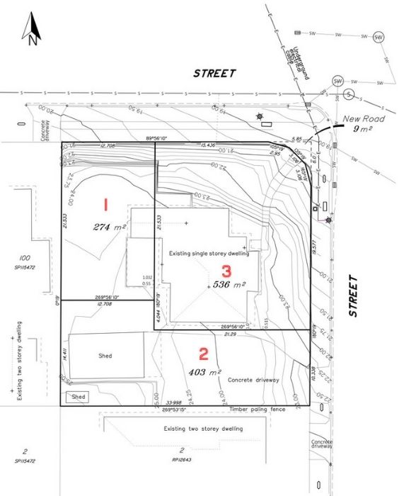
Other considerations for proposal plans include, but not limited to potential flooding, overland flow, biodiversity areas, new roads, size of roads or the ability for bin trucks to turn around.

In simple terms, a proposal plan provides the relevant land and building information relative to one or many land parcels and includes the proposed future use and subdivision of that particular land parcel(s).

We would love to work with you.

Tell us about your project via the form below or get in touch over the phone to discuss how we can improve your project.

Call Now Button