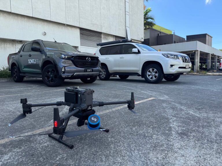
Aerial drone surveying uses UAVs equipped with high‑resolution cameras and LiDAR sensors to capture accurate spatial data from above. It’s ideal for complex or large sites, stockpiles, earthworks, subdivisions, and hard‑to‑access areas.
At Sonto, we combine drone capture with survey control and professional processing to deliver orthophotos, point clouds and surface models that support design, planning and construction – faster, safer and with less site disruption.
We define capture requirements and establish survey control to ensure aerial data aligns accurately with ground coordinates and design systems.
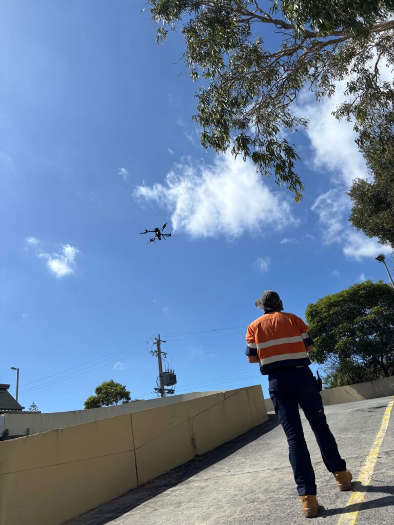
Our licensed pilots fly automated missions to capture high‑resolution imagery across the site efficiently and safely.
Captured imagery is processed into orthophotos, point clouds and surface models, ready for measurement, modelling and analysis.
We deliver clean, accurate datasets compatible with CAD, BIM and GIS platforms, supporting faster decisions and workflows.
We define capture requirements and establish survey control to ensure aerial data aligns accurately with ground coordinates and design systems.
Contact us for a quoteOur licensed pilots fly automated missions to capture high‑resolution imagery across the site efficiently and safely.
Contact us for a quoteCaptured imagery is processed into orthophotos, point clouds and surface models, ready for measurement, modelling and analysis.
Contact us for a quoteWe deliver clean, accurate datasets compatible with CAD, BIM and GIS platforms, supporting faster decisions and workflows.
Contact us for a quoteBy combining licensed pilots, proper survey control and rigorous processing, we deliver aerial datasets you can trust for real design, planning and construction outcomes.

We confirm site size, outputs and accuracy requirements before planning the flight.

Survey control ensures aerial data aligns with real‑world coordinates and boundaries.

Our pilots conduct efficient, compliant flights to capture consistent, high‑quality imagery.

We turn raw imagery into usable spatial products, ready for modelling and analysis.
Drone surveying is ideal for large sites, subdivisions, earthworks, stockpiles, corridors, and inaccessible areas. It provides fast, consistent coverage where traditional ground surveys would take significantly longer or pose safety challenges.
Yes, when combined with survey control. We use ground control points to ensure aerial datasets align accurately with real‑world coordinates, making them suitable for design, measurement and analysis.
Common outputs include orthophotos, digital surface models, point clouds and volume calculations. We tailor deliverables to your project needs and preferred software platforms.
Most sites can be captured in a single day, with processing completed shortly after. This makes drone surveying one of the fastest ways to obtain spatial data across large areas.
Yes. Our licensed pilots operate in accordance with CASA requirements, and we manage airspace approvals and compliance as part of the service.

If you need fast, accurate aerial data for planning, design or construction, we’re ready to help. Call, email or submit your details to organise an aerial drone survey today.