Our BIM and 3D modelling services turn rich point cloud data into accurate digital twins, ready for design, analysis and coordination.
From internal fit‑outs and building extensions to services planning and clash detection, our models are built from real survey data, not guesswork. We tailor LOD and deliverables to suit architects, engineers and construction teams, making project decisions faster, clearer and more reliable.
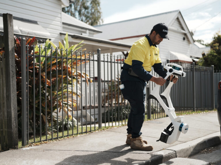
We use survey-validated LiDAR to scan built environments in high detail, capturing millions of spatial data points.
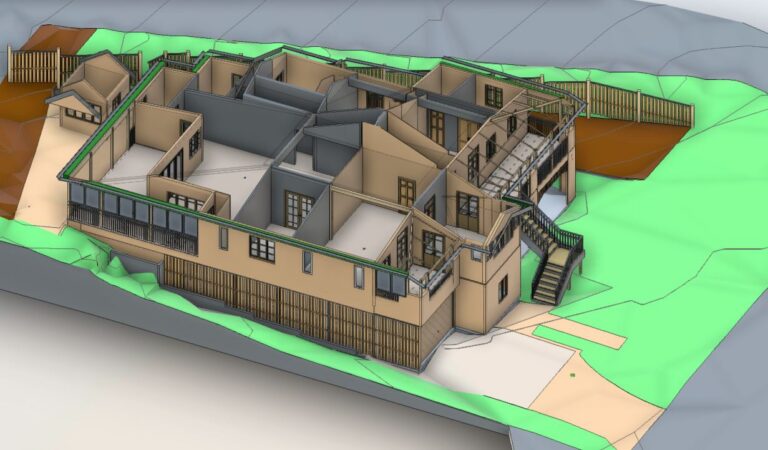
We build BIM models to match your Level of Detail (LOD) and discipline, from concept massing to construction detail.
We model architectural elements, structural features, services, and site context from survey‑grade point clouds.
We supply models in RVT, IFC or DWG format, ready for use in Revit, Archicad, Navisworks and more.
We use survey-validated LiDAR to scan built environments in high detail, capturing millions of spatial data points.
Contact us for a quoteWe build BIM models to match your Level of Detail (LOD) and discipline, from concept massing to construction detail.
Contact us for a quoteWe model architectural elements, structural features, services, and site context from survey‑grade point clouds.
Contact us for a quoteWe supply models in RVT, IFC or DWG format, ready for use in Revit, Archicad, Navisworks and more.
Contact us for a quoteOur BIM and 3D models are built from point cloud data captured through laser scanning and drone capture. This means fewer clashes, faster coordination and better design certainty.

We capture spatial data using LiDAR, drone or photogrammetry based on your scope and site.

We define model scope, disciplines and LOD requirements with your team before starting.

Our team constructs clean, accurate 3D geometry, focused on the data that matters to you.

We provide models in your required formats, plus any help you need to integrate or visualise.
BIM stands for Building Information Modelling, and is a digital representation of a physical space or asset, useful for design, coordination, construction, and facilities management. It’s especially valuable for complex or multi‑disciplinary projects.
We can model internal walls, floors, ceilings, structure, roof geometry, windows, doors, stairs, services and more, all from real scan data. The level of detail depends on your needs.
We can supply native Revit (RVT), IFC, DWG, or other formats depending on your design platform. We also provide point clouds (E57, RCS) if your team prefers to model in‑house.
We can, but we don’t recommend it. Survey‑grade scanning gives a far more reliable and complete base than working from outdated or incomplete drawings.
Our models are built from point cloud data tied to survey control. That means positional accuracy within centimetres, far more precise than generic scan‑to‑mesh or hobbyist capture tools.

If you need real‑world spatial data turned into accurate models for design, planning or coordination, we’re ready. Get in touch today to get started.