Contour and Detail Surveys are the essential first steps in any development or construction project, capturing precise land elevation information, boundaries, and any other site characteristics that are essential to know for your project.
Sonto delivers high-quality, precise, and comprehensive contour plans based on our innovative 3D scanning technology that sets the standard for project accuracy and efficiency, allowing you to make fully informed decisions for even the most complex of constructions.

We capture detailed, reliable site information including levels, features, structures and visible services across your site. This gives your design team a clear and dependable foundation, helping reduce assumptions and ensuring your project starts with accurate, real-world data from the outset.
Our surveys are carefully calculated and aligned to cadastral boundary data, not assumed features like fences or walls. This ensures your design is based on true legal boundaries, helping avoid costly errors, redesigns or issues later in planning, approvals or construction.
We understand that projects often stall waiting for survey data. Our streamlined workflows and responsive team allow us to deliver detail surveys quickly, helping your project move into design, planning and approvals without unnecessary delays or extended timeframes.
Our surveys are structured specifically for architects, planners and engineers, ensuring the data is clear, usable and ready for real project workflows. This reduces the risk of redesign, supports smoother approvals, and helps your project progress efficiently from concept through to delivery.
We capture detailed, reliable site information including levels, features, structures and visible services across your site. This gives your design team a clear and dependable foundation, helping reduce assumptions and ensuring your project starts with accurate, real-world data from the outset.
Contact us for a quoteOur surveys are carefully calculated and aligned to cadastral boundary data, not assumed features like fences or walls. This ensures your design is based on true legal boundaries, helping avoid costly errors, redesigns or issues later in planning, approvals or construction.
Contact us for a quoteWe understand that projects often stall waiting for survey data. Our streamlined workflows and responsive team allow us to deliver detail surveys quickly, helping your project move into design, planning and approvals without unnecessary delays or extended timeframes.
Contact us for a quoteOur surveys are structured specifically for architects, planners and engineers, ensuring the data is clear, usable and ready for real project workflows. This reduces the risk of redesign, supports smoother approvals, and helps your project progress efficiently from concept through to delivery.
Contact us for a quoteAt Sonto, our approach is to support your vision with precise, actionable data that enhances design accuracy, cuts down on project timelines, and makes sure you have total transparency at the outset of your development.
Our goal is to make sure that you have the most comprehensive, contextually rich survey datasets at your fingertips to improve the outcomes of your design and construction.

We carry out a desktop assessment and search of relevant survey information to conduct pre-calculations of boundary information & review other online databases to ensure all surveys are survey-grade accurate.

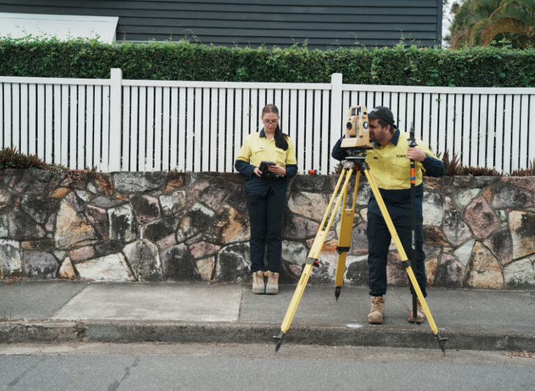
We come to the site and gather precise property data using a potential combination of survey total station, GPS, drone and 3D scanning technology.

We convert the survey data on AHD datum into easy-to-read plans and maps for your project, clearly representing your site in 2D form. We also package the 2D CAD-ready data for direct import into design software packages.

At the end of the job, we are available for consultation and to discuss any further project-based questions regarding the survey as required.
The duration of a contour survey can vary depending on the size and complexity of the property, as well as the specific requirements of the project.
Generally, a standard residential contour survey can be completed within a few weeks from the date of acceptance, but larger or more intricate sites may take longer to ensure accuracy and detail, depending on the size and scope. We strive to provide quick turnaround times while maintaining high standards of quality and precision.
A contour survey is minimally disruptive to the site. Our advanced surveying techniques, including 3D scanning and drone technology, allow us to gather detailed topographical data without the need for extensive physical interaction with the terrain. This approach ensures that the integrity and appearance of the site are largely preserved throughout the surveying process.
Yes, a contour survey is highly beneficial for flood assessment. By providing precise topographical data and elevation points, it helps in understanding how water flows and accumulates on a property. This information is crucial for planning effective drainage solutions, designing flood mitigation, and ensuring compliance with local building regulations to mitigate flood risks.
At Sonto, we utilise cutting-edge technology for our contour and detail surveys, including any combination of survey total stations, GPS, 3D scanning and advanced drone systems. This allows us to capture high-resolution data and generate accurate 2D plans & 3D models, including contextually rich point clouds of the surveyed areas.
Our commitment to using the latest technology ensures precision and efficiency, enabling us to deliver high-quality survey & spatial data to our clients.
Get reliable and high-quality data with our innovative survey solutions. Get a quote now and start planning with confidence.
Yes, your Sonto detail contour survey will meet all regulatory requirements. We adhere strictly to industry standards and local regulations, ensuring that all data collected is both accurate and compliant. All of our contour and detail surveys are carried out relative to survey information, including boundary, Australian Height Datum (AHD), and relevant GNSS datums, ensuring precision and compliance in every project.
Ready to get started? Contact us to make sure your survey is compliant and precise.
Yes, if added to the scope of works, we can pick up the accurate location and depth of underground services. At Sonto, we coordinate with accredited and authorised third-party specialists who are experts in underground service locations using advanced technologies. This approach ensures that all underground utilities are identified accurately and safely, supporting efficient project planning and execution.
However, if this additional scope is not selected or chosen, we access and utilise online council databases to plot and map known underground services on the detail survey plans. This integration provides a preliminary understanding of existing utilities, aiding in the planning and decision-making processes for your project. If we are not engaged to accurately locate the underground services, we cannot ensure the accuracy of those assets plotted from council records.
For projects where underground services traverse or exist near the proposed construction or development area, we highly recommend selecting a service location as part of the survey scope. This ensures that all subsurface utilities are precisely identified, which is crucial for avoiding disruptions and additional costs during construction. Incorporating this detailed mapping into your planning process reduces additional survey costs, minimises risk, and ensures a smoother project execution.

Give us a call or fill out this enquiry form.
Our team will organise a consultation for you.
Or leave your message below and we’ll get in touch soon.