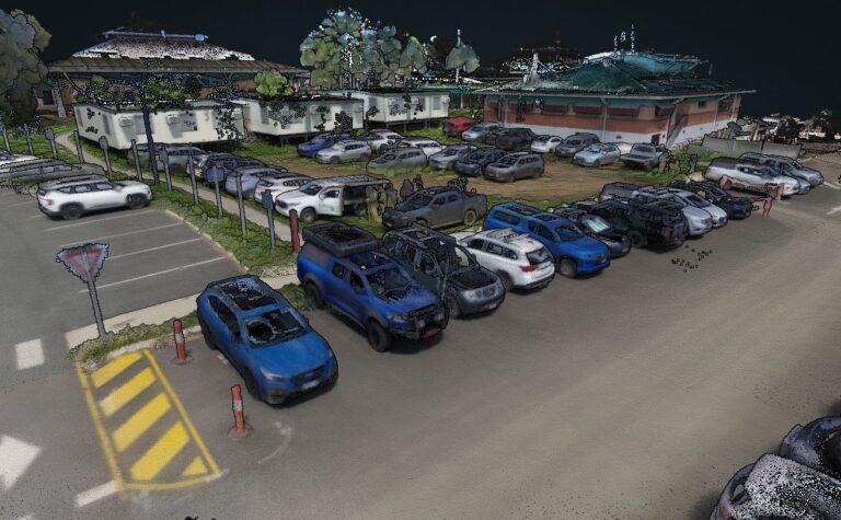
3D scanning (often using LiDAR) captures the built world with exceptional detail, generating dense clouds of data that represent real surfaces, structures and spaces. It’s ideal for design validation, renovation, BIM modelling, heritage recording, and complex site documentation.
At Sonto, we combine advanced scanners, expert workflows and robust processing to deliver rich datasets that save time, reduce rework and give your team a full digital twin of the real world.
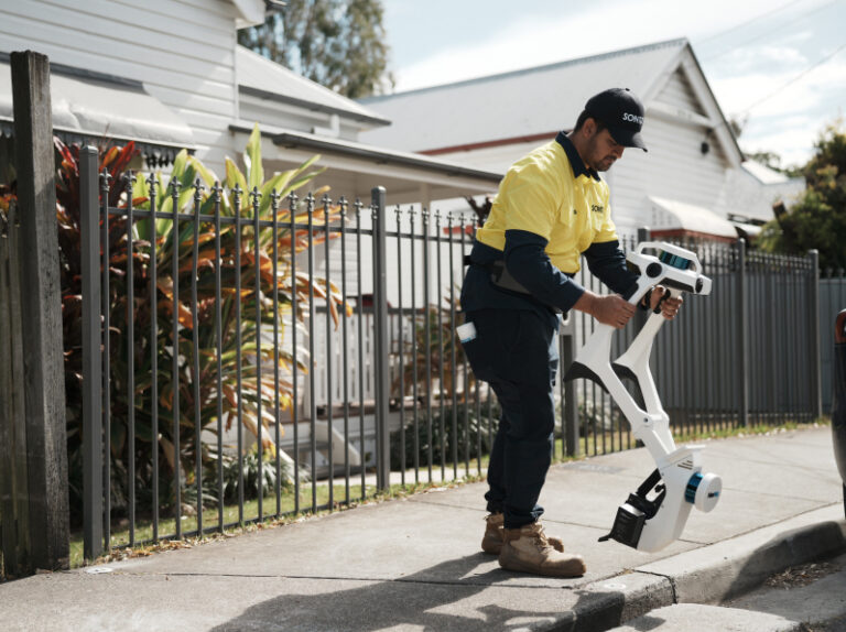
We use laser scanners and LiDAR to record millions of spatial points that represent the physical geometry of your site, inside and out, with excellent resolution and accuracy.
Scanning picks up walls, floors, ceilings, fixtures, services and structural detail, giving you complete spatial context for design or modelling.
Our expert team captures data quickly and safely, reducing onsite time while ensuring maximum data coverage and quality.
We process raw scan data into point clouds and deliver clean, usable files compatible with BIM, CAD, and visualisation platforms.
We use laser scanners and LiDAR to record millions of spatial points that represent the physical geometry of your site, inside and out, with excellent resolution and accuracy.
Contact us for a quoteScanning picks up walls, floors, ceilings, fixtures, services and structural detail, giving you complete spatial context for design or modelling.
Contact us for a quoteOur expert team captures data quickly and safely, reducing onsite time while ensuring maximum data coverage and quality.
Contact us for a quoteWe process raw scan data into point clouds and deliver clean, usable files compatible with BIM, CAD, and visualisation platforms.
Contact us for a quoteWe tailor capture strategies to project needs, execute efficient fieldwork, and produce datasets that empower downstream design, analysis and delivery. We don’t just scan, we make sure the data works for you.

We clarify what elements need scanning, your accuracy needs and output formats before arriving on-site.

We plan capture paths, control points and scanner setups to maximise efficiency and coverage.

Our team captures the site with advanced LiDAR and laser scanners, backed by accurate survey control.

We turn raw scan captures into usable files, point clouds, meshes and deliverables that plug into your workflow.
3D scanning (LiDAR) captures dense spatial data across surfaces and volumes, providing a rich visual and geometric dataset, whereas traditional surveying collects specific control points or lines. Scanning gives context and geometry that speed design and modelling tasks.
Yes. Our scanners are versatile and capture interior spaces as well as external surfaces, making them ideal for building documentation, façades, complex geometry, and mixed environments.
Accuracy depends on project requirements and setup, but our SLAM LiDAR and laser scanners deliver ~10 millimetre‑level accuracy pointclouds suitable for modelling, verification, and design workflows.
We deliver data in formats compatible with most CAD, BIM, and point cloud tools. And through platforms like Nexus, you can view datasets directly in a browser without special software.
Turnaround varies by scope, but our workflows prioritise efficiency. Many datasets are processed and delivered within days rather than weeks, accelerating design and planning workflows.

Whether you need high‑resolution as‑built data, BIM support, or rich point clouds for design, we deliver the detail you need. Call, email or send your project details to get started.