
Precise spatial and survey data is the foundation of exceptional design.
When designers have access to the most accurate, comprehensive, and contextually rich information possible, they can more fully understand the constraints of a project site, its hidden opportunities, and any nuances that can help better align client aspirations and practical realities.
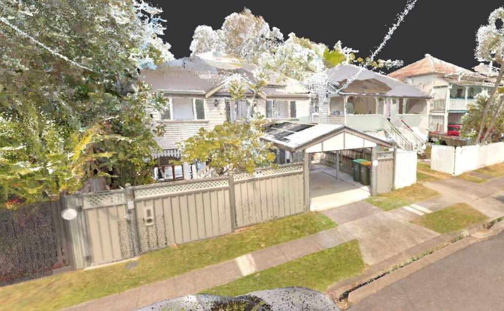
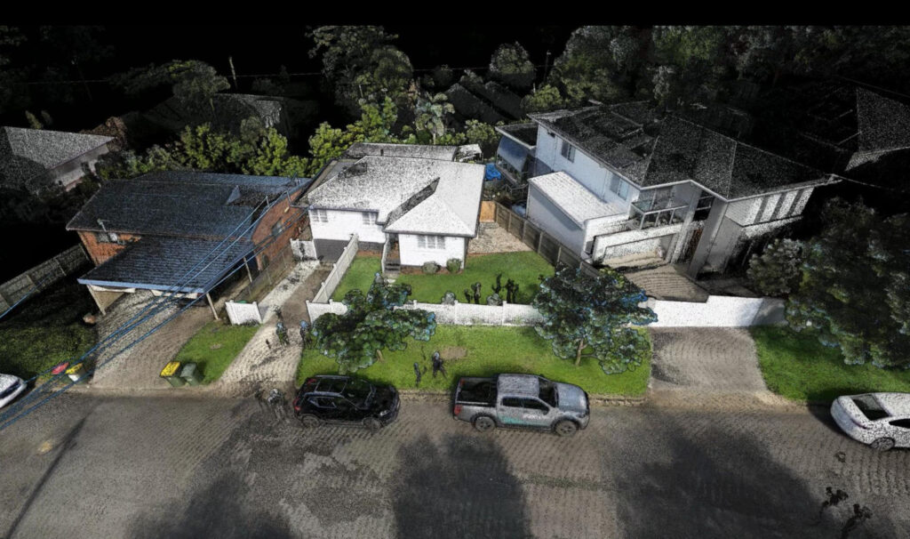
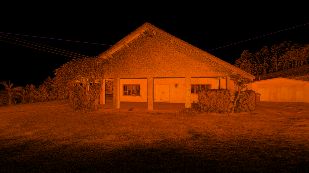
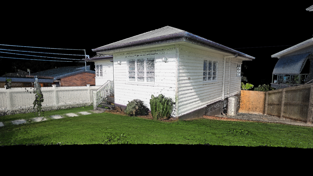
Today, spatial and survey data has come further than ever before in delivering the most precise and accurate development information. New technologies like point clouds (which provide incredibly detailed 3D representations of spaces) and 360-degree walkthroughs (which create immersive, interactive visualisations) deliver a far deeper understanding of your property, identify key challenges, avoid costly mistakes, and accelerate the design process – all while ensuring the final result is truly aligned with your vision.
So, what are the exact benefits of staying up-to-date with these latest spatial and survey data technologies – and why are they an investment worth making? Let’s take a look at some of the major points of difference.
How does better spatial & survey data benefit your home design projects?
Richer, more contextually relevant information
By using innovative technologies such as point clouds, you have easy and direct access to a far greater realm of information than has before been possible.
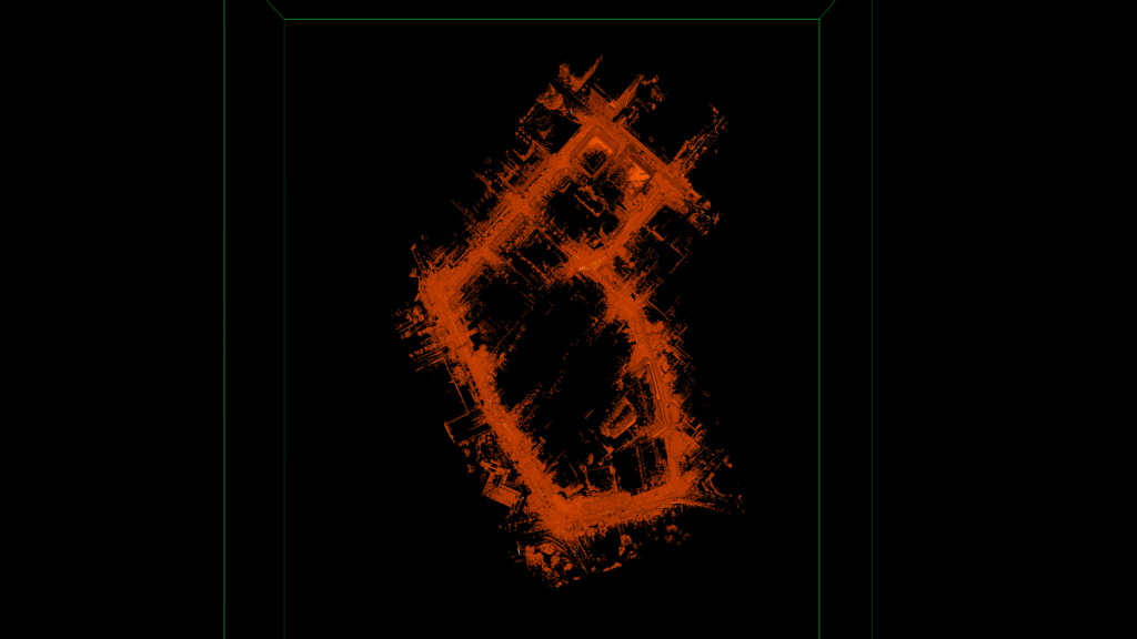
Point clouds are dense collections of spatial data points captured via laser scanners or photogrammetry, providing precise 3D representations of existing spaces. This detailed information allows designers to understand the exact dimensions and conditions of a site to make sure that every design decision is grounded in reality and on specific, actionable insights.
For instance, point cloud data can be used to create virtual models that mirror physical spaces (also known as digital twins) that allow for a far greater degree of analysis and planning in the critical early stages.
Filling any data gaps
Traditional measurement methods often miss key details, especially in complex or hard-to-access areas. Point cloud technology captures millions of data points in a single scan, leaving no corner unexamined. This thoroughness provides a complete dataset that reduces errors and oversights during design and construction.
Fewer return visits to your site
With the level of comprehensive data able to be collected in only a single session, designers can save time and reduce delays by minimising the number of return visits needed to the site. Instead, you can simply refer to the detailed point cloud and 360-degree walkthroughs for all necessary information.
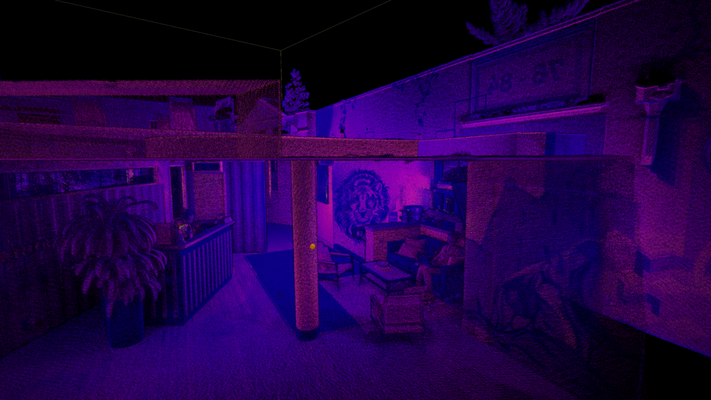
Better project visualisation
360-degree walkthroughs offer fully immersive experiences that allow stakeholders to virtually navigate through the proposed design. This level of visualisation helps a great deal when it comes to understanding spatial relationships and aesthetics, and which in-turn fosters better communication and decision-making amongst clients, designers, and builders alike.
Identifying key property constraints
Detailed scans will reveal existing structural elements, utilities, and other constraints that have the potential of impacting the overall design. By identifying these factors as early as possible, designers can develop solutions that will integrate seamlessly with the current conditions and avoid the potential of costly modifications later down the road.
Preventing costly issues
Being able to detect such issues as structural weaknesses, misalignments, or spatial conflicts at an early stage through detailed scans prevents expensive problems from surfacing during construction and at the same time reduces rework or budget overruns.
Faster turnaround to concept design
The level of precision and data comprehensiveness that comes from point clouds and 360-degree walkthroughs help streamline the design process and accelerate project timelines, since designers can move swiftly from data collection to concept development and finally deliver results far more efficiently.
Better data means better results (and less cost) for your home designs
Remember, making the leap to using more advanced spatial and survey data isn’t just about improving accuracy – it’s about creating designs that are smarter, faster, and more aligned with your needs.
Point clouds and 360-degree walkthroughs are new but powerful technologies that empower designers with the tools they need to optimise every stage of the process, from initial concepts to final execution. And by integrating these innovations into your own projects, designers can produce homes that are not only visually stunning but are also practical, which avoiding costly mistakes throughout the whole design process, and which (in the end) have a result that exceeds expectations.